Nov 2, 2026
Field notes: the alignment that pencilled on paper and died at the first culvert
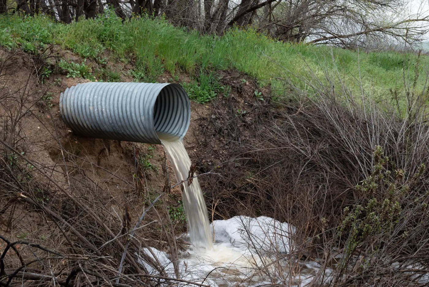
Alignment B-2 looked clean. Favorable grades through the saddle, a wide enough bench for the typical section, and it threaded between two wetland polygons without clipping either one. On the GIS screen it was the obvious front-runner over B-1, which had to climb a steeper slope class and eat into a mapped floodplain buffer. We ranked B-2 first, wrote it up, and sent a two-person crew out to ground-truth the stationing before we committed survey hours to the whole corridor.
They came back with photos of a culvert nobody had flagged.
It sat at station 14+80, a 36-inch corrugated metal pipe carrying a perennial drainage under an old farm lane that the LiDAR-derived slope raster had smoothed right over. The existing structure was undersized for the contributing drainage area, badly skewed to the proposed centerline, and sitting with maybe eight inches of cover where our typical section called for three feet. None of that shows up in a slope mask. None of it shows up in land cover either, because the crossing itself reads as bare ground or scrub, same as the pasture on either side.
This is the gap between desktop screening and field reality that nobody budgets time for until it bites them. A slope layer tells you where the grades work. A built-up mask tells you where you're going to be fighting right-of-way acquisition. Land cover tells you where you're clearing timber versus crossing open ground. None of those layers know where the drainage structures are, what condition they're in, or whether the existing pipe was sized for a 1985 subdivision instead of whatever's coming once the rest of the watershed develops. That's a field finding, and it's exactly the kind of finding that should surface before you pick a favorite, not after.
What made B-2 painful wasn't that the culvert existed. Culverts exist everywhere; that's not news to anyone who's run a corridor study. What made it painful was the order of operations. We'd already told the client B-2 was the leading candidate. We'd already started scoping full topo on that alignment. Walking it back to B-1, after the fact, cost us the appearance of having done our homework, even though the homework we'd done was the homework the tools let us do.
Nobody has the field budget to survey every candidate at the screening stage, and a slope-plus-land-cover GIS layer was never built to see a drainage crossing in the first place. Skew angle at a crossing, existing structure condition, and built-up density near the right-of-way corridor are all visible from above, well before survey stakes go in the ground. Stack those together instead of eyeballing them layer by layer on three separate screens, and the field list narrows before a crew ever gets mobilized.
That's the part we changed afterward. Instead of ranking candidates off slope class and land cover alone, we started pulling a combined constraint view for every corridor study at kickoff, something closer to what Route Selection Map lays out as a scored comparison across candidates before anyone books a survey crew. The crew still has to walk the pipe at 14+80 and confirm what's there. Now that alignment dies on a screen during scoring, weeks before a schedule gets built around an assumption that B-2 is settled.
B-1 went to full design. The floodplain buffer was a non-issue once we got actual grading in there. The culvert on B-2's route is still waiting on county maintenance, same as it's been for a decade.
If you'd rather find the culvert before you rank the alignment, that's the whole idea behind Route Selection Map.